Moving On

The original purpose behind The Fourteen Percent Ride has long since been fulfilled. So, I've decided that Mighty Proud will be the last posting. It just seems right.

But, don't worry. Or maybe you should. In any event, I plan to continue. I'll keep riding. And writing. Click here to come along in my new blog ~ The Long White Line. <-- check it out!

Thanks

As I've ridden for the last two years, I've picked up on the fact that Shirley, my darling wife, has been more worried about my safety than impressed with my "accomplishments." How do I know this? Well, when I'd come back and tell her, for example, that I'd hit 53.6 mph going down FO, she'd reply, "I don't want to hear it." Being the sensitive sort I figured out, after many such comments, that just maybe we were not on the same page here. But last week, she told me that she would "greatly reduce her focus on the 'fear for my safety' issue." We talked about the tour, looked at some maps, researched nutrition suggestions on the internet, and so on, just enjoying the idea of the ride. How nice is that? Thank you, Shirley!
Showing posts with label The Ride. Show all posts

Thursday, July 5, 2007

Paradise

Saturday, June 23
Thompson Falls to Missoula

I rode through Paradise today. And the other place. Sort of like every day of the ride (except for the Spokane to Kellogg leg), where there were relatively easy stretches and then some hard parts. Today had one of the easier easy parts. And one of the harder hard ones.

Here it is, the last day...

After six days of riding, 515 miles on the road, we come to the longest ride of the Northwest Sampler tour. An entire week without ever seeing the sun set. Every day with nothing to do but get ready to ride, ride and recover from the ride. Do it one more time and the tour is over. As “momentous” as this day is, I do not recall thinking anything different on this morning as I rolled up the tent for the last time, hauled the bags up into the back of the Penske truck and rode off to the Elks club for breakfast. It is a another day to ride.

And what a ride it was. Once again we are treated to spectacular scenery as we ride along Montana 200. About 10 miles out of Thompson Falls, rocky hills come down and hug the road. The sign up ahead says “Watch for bighorn sheep. Next 12 miles.” And I did. But there were none to be seen on this morning. Still, a nice ride and I notice that the pace is pretty fast. The road is flat to gently rolling and there is a nice tailwind. The miles roll by as I ride on, looking up and to my left from time to time in hopes of spotting one of the aforementioned bighorns.

Along the way, we ride through Eddy and Wild Horse. The valley widens and the hills are now a mile or two away, ranches taking up residence in the grassy plains. At the 31 mile mark, we come to the water stop. It is Paradise. Paradise, Montana. So, this is what it is like. Not bad.

The wind continues to push and we arrive at the picnic stop in Dixon. My computer tells me I have averaged 19.2 mph over this first 57.5 miles of the ride. We are at a small park and it does not take long for one of the locals to come up and check things out - a slow moving black lab who, before this day is over, will be in his own handout paradise. The Dixon Senior Center is behind the park. It is a social club and there is a rummage sale going on. Apparently this is Sale Day in Montana as there have been signs everywhere. I go in and ask about using the facilities. The ladies watching the wares say that they do not think the Dixon seniors will mind; in fact, they tell me I can let Michelle know that she can direct the riders in as they arrive. A welcome invitation it is.


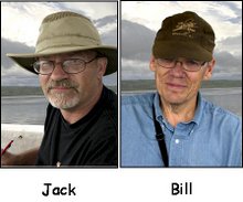
We have 7 miles of riding to get to the next turn on the route sheet where highway 200 comes together with highway 93, the route between Missoula and Glacier National Park. We are not in Paradise anymore, Toto. This is without doubt the most bicycle hostile route of the trip. It is a very busy two-lane highway, with heavy, fast moving traffic, much of it motor homes or trucks pulling trailers. The shoulder is wide, but there is a nearly continuous rumble strip just outside the white line. This means you have to ride the line and expose yourself to the traffic or ride in the debris field that is on the other side of the strip. We are on this road only briefly when Bill gets a flat. It promises to be a long stretch.

It is getting warmer, there is not so much a push from the wind anymore and the scenery is a bit less interesting. Cars whizzing by and the continuous grind trying to negotiate the rumble strip add to the grief. Then it gets hard. The road begins to rise. It isn’t much, but I really start to drag. There is a “good downhill” listed on the route sheet, but it is still 8 miles away. One of the least pleasant hours of the whole tour was spent on this section of Highways 200 and 93.

The highway eventually flattens out a bit. Then, it expands to four lanes and I can see the transition to a downhill grade up ahead. We met a self-supporting biker when Bill was fixing his flat. He told us that the descent into Missoula was a 40 mph downhill. I start down and the riding is easier. But it is hardly 40 mph. About half that actually. Still, it is a big improvement.

Then I see it. The road ahead just disappears over the edge at the start of the real descent. As I go over, I’m looking down a steep drop with the road sweeping around to the right. I do not think that this descent was all that much steeper than others on the trip, but it looked really nasty. Maybe it was the accumulated difficulty of the last few hours, the thought of dealing with traffic, not knowing what the hill looked like around that curve. But, it was there, between me and Missoula, so over I went. How was it? Nerve wracking. Not Paradise, to be sure. More like, … well, you know. Rolling around the first big curve, the descent continues unabated towards another big bend, this to the left. After that, I’m looking down a long stretch with the road continuing to cascade down the hill. I am still dropping at over 40 mph, but at least I could see the bottom and feel a little better. When I reach the flatter section, I realized that I was able to make the entire descent without having a single car or truck come up behind me. A little bit of Paradise, maybe.

There were a couple of navigational incidents in the last 12 miles, but eventually I was following the yellow arrows on a grand tour of the University of Montana campus. Pulling up into the parking lot at the dorm, I think, “I did it!” As I’ve said, you are allowed these moments on rides so I allowed myself to celebrate. Quietly.

“I did it!” *

Today’s ride ~ 104.5 miles
Trip total ~ 619.2 miles
Ride time ~ 5 hours 55 minutes

* Lest you get too impressed, there were 33 other riders who made it to Missoula. Thirty one of them kept going and 26 of them plan to ride until they dip their front wheels in the harbor at Boston. Now THAT's impressive.

Wednesday, July 4, 2007

Wordless Wednesday

So if I have to explain the posting today, it really isn't wordless. We'll call it Not so Many Words This Time, then. The slide show has pictures from our overnight, picnic and water stops. Except for the moose. He's there because it was cool to see a moose. Check in tommorrow (July 5) for the account of the last day of the ride.

Tuesday, July 3, 2007

Riding High

Friday, June 22
Kellogg, Idaho to Thompson Falls, Montana

Kellogg, Idaho is home to the world’s longest gondola, if you believe the sign at the boarding station. You can ride up to the top of one of the mountains that surround the town and come back again. You end up having gone nowhere, but with, I am sure, a lot of oohs and aahs along the way. And maybe a few shivers, depending on your attitude about altitude. It isn’t the destination, it’s the journey. It makes me think of the training I did. Two thousand miles and on the day before leaving for this trip I was still in La Crosse. But it was quite a journey in those two months that I rode. Two bikes, all the hills and rides along the river. Now, on this journey, one with a destination - Missoula, Montana - I am having the time of my life. Every mile something new. Well, there were those few endless stretches in the high plains, but even they have their place in the patchwork of experiences that make up the journey. This was a journey I had sought, worked for. Wanting the experience of long rides, big climbs, new landscapes. It has not disappointed.

After taking four and one half days to ride across Washington and get into Idaho, we will cross the Montana state line at about the two-thirds point in today’s short ride. When I wrote this in my paper journal, it struck me that in a matter of just a few days, 69 miles had become a short ride.

In spite of the pace of yesterday’s ride, I feel very good upon arising early on this Friday morning. We backtrack on the bike trail for about 7 miles then head off to the northeast on River Road. This is another of the several nice rides on winding roads and rivers. We are making our way towards Thompson Pass. On the route sheet, I read, at the 42.6 mile mark, "Long Climb 1 1/2 miles 9%." I'm not up on grades. We apparently did some 6%'s earlier, but I can't really picture 9%. Well, actually I can and it is not too pretty. We stop briefly at a Husky service station and get chilled Starbucks Frappuccinos. The guy holding down the fort tells us about the fishing in the nearby river - cutthroat trout. I can see it now: fishermen pull up in a rugged four wheel drive, saunter into the store and come out loaded with six packs of caramel latte coolers. A day in the wilderness.

Off we go, soon to turn off onto Thompson Pass Road. Just another spectacluar ride in the Idaho panhandle. It is 14 miles to the 9% climb, but the climbing starts much sooner. First 2% then 4%, up to 6% (yes, I'm guessing). Finally the road takes a sharp turn to the right and THE climb begins. I pedal along in low gear. It is not easy, but not, on the other hand, nearly as hard as I had expected either. Near the top of the pass, I am riding from one marker to the next (reflectors at 0.05 mile intervals), but it is clear now that I will make it to the pass, this one topping out at about 5,000 feet. And so I do. The picnic stop is set up in the parking lot of the overlook. Michelle is cooking sausages to go along with the rest of the generous lunch goodies.

You can look down on the road that you have just ridden up. It looks far away. It is far away. This is where you are allowed to pause and reflect, "I just rode up that road on a bike!" It feels good to sit on the rock in the warm sun and enjoy the achievement.


Soon it is time to go. Another long, tense downhill. Not terribly steep - about 35 mph for the most part, but it goes on and on. Once down to the lower levels, I ride through a few "towns," but it is mostly forested hills. Turning onto highway 200, I am greeted by a sign that says Thompson Falls. Montana. I never saw a Welcome to Montana sign and wonder when the border crossing actually happened. Several other riders commented later that they did not notice any acknowledgement of the Idaho-Montana border either.

After setting up our tents, we decide to walk back into town for the afternoon refreshment. We meet one of the local residents on the sidewalk and, being the observant sort, he notices that we are "not from around here," as he puts it. Wonder how he could tell? I say we are biking through and he says, "I ride a Harley myself. But, there's nothing wrong with a good Honda or Yamaha." "Bicycles," I tell him. "Oh. I'm not much for riding them." I never would have guessed. Later he tells us that he owns a town on the road back towards Thompson Pass. "It's just something I do," he says, as if this explains everything.

We have some transportation issues to deal with which end up in us having to walk back to the school to get a ride to dinner at the local Elks club, about two miles on the other side of town.

Today's ride ~ 69.6 miles
Trip total ~ 514.7 miles
Ride time ~ 4 hours 41 minutes

Monday, July 2, 2007

Missing the Mark; and Hitting It

Thursday, June 21
Spokane to Kellogg, Idaho

One of the things I learned about this bicycle touring thing is that you need to be able to follow the marks, the yellow arrows painted on the road by the routers. Sure, there was the Route Sheet, but it had 20 or 30 separate instructions and I do not have a photographic memory. I’d look at it, try to anticipate the route, but it was finding those arrows that was the real key to success. Missing one was a recipe for, well, an unexpected adventure. Just ask Roy. He missed a turn at Coeur D’Alene Lake and ended up in Plummer, Idaho. The picnic stop was in Harrison. Harrison is not too near Plummer. But, all’s well that ends well. Roy actually became a celebrity in Plummer. The tribal police force took him in, arranged for a lunch, took pictures with him and gave him a departmental shoulder patch. And, Carol went and got him back on track for the remainder of the ride.

Today we cross the state line and work our way to Kellogg, Idaho. And we had a decision to make right away. The food services at Gonzaga were prepared to have our breakfast ready at 7:30 a.m. This was halfway through the morning! Bill suggests and I agree that we will leave early and get our own breakfast. We stick to this plan even after an agreement is negotiated to have the breakfast ready at 6:30. So, around 6, we take off. Somewhere in southeastern Spokane, we pull into a bakery and have breakfast with good, strong coffee, fruit and pastry. Bill had quiche. Isn’t there something about “REAL men…?”

Then, we head out on our third straight long ride. It isn’t long before we get out of town and into a valley where we meet, head on, a stiff wind. This is not looking good at all. We struggle on and, to my relief, the wind dies down a bit. Out in open country, we ride along again on rolling hills under a generally clear sky. Once, out of nowhere, I feel rain drops. There are no clouds nearby, so I surmise that this is rain that has blown in from Seattle. It does not last long and we ride on. After the first water stop, we come to a collection of signs on the side of the road…”Idaho State Line” and “Entering Coeur D’Alene Indian Reservation.” Yet another milestone.

We push on, past the Casino and along a fairly busy highway. I’m still feeling pretty good, pedaling along, watching the tenths click off on my computer. In the groove, I guess. Then I hear something behind me. I look in my mirror and see Bill pumping furiously, calling to me, “Jack, you missed the mark!” I’d been ahead of him for a while and when I went past the turn, he had to find the extra gear to get close enough to hail me down. He said later that he had called several times and if I hadn’t noticed him this time, he’d have let me go. Wonder where I would have ended up?

Back on track, we negotiate about six miles of rollers that seem to get progressively higher as we go. Then, we turn and start a descent, now in a thick forest. We bump over the first of two cattle guards marked on the route sheet. This one surprises us and our passing is at high speed. Thankfully, it is a smooth “crossing.” A few more turns and suddenly we are treated to a magnificent view of Coeur D’Alene Lake below us. It is an absolutely breathtaking sight.

We wind our way down the road and at lake level, get on the wide paved bike path that will take us the remaining 48 miles to Kellogg. This is a “Rails to Trails” project and soon after we get onto the path, we cross a picturesque railroad bridge. The path is very cleverly stepped on the climb to the high point and again on the other side, the descent for us.

The path winds around the lake and we slow down, take in the wildflowers, trees, and panoramic views across the water. It is a great ride. We are soon in Harrison, having lunch at a small city park looking out over the lake. There is an espresso bar across the street, and I look forward to a midday coffee after lunch. It was, alas, not to be. When I went over, I found the shop to be closed. Oh, well. And, it was off again to finish the ride to Kellogg.

The general idea was to ride an easy pace through this beautiful countryside. I went out at a comfortable pace and soon found myself far ahead of Bill and Craig. Looking at the computer, I see I’m going along at a 22 mph clip. We stop at one point to photograph a young moose just off the side of the trail. Bill says, “This isn’t a time trial.” I reply, “I know. But, I have never, ever felt this good on a bike.” I just have to go. And go. I’m enjoying the view; I don’t feel like I’m working hard; I’m just going. It was an amazing, and heretofore never experienced sensation.

I go on, clicking off the miles. At about ten miles from Kellogg, I began to realize that Neil and Kimmarie, who were at the lunch stop when we left, had not passed me yet. I was on track to be first to arrive at the school in Kellogg. I tell myself that this is not important. Just enjoy the ride. But at five miles out, I finally decided I want to be the first in. If I am, I know, it is only because Neil and Kimmarie took a really long lunch. Still, I was now set on getting in ahead of the rest of the tour. I had slowed down a bit, settling into what seemed to be a very easy pace, but still making good time. Then, a surprise.

As I entered Kellogg I looked in my mirror and saw Bill and Craig, very close and closing. As I said earlier, this ride was in general not a competition for me. But at this particular point, it was. For the next mile, anyway. So, I stood up and picked up my speed. I heard Bill holler, “Jack…” but on the now fairly narrow and winding bike path, he had to fall back. He said later that he was going to say as he went past, “Don’t mess with the peloton.” But, surprisingly, I still had some legs left and sprinted to the end of the bike path. Just a few blocks from the school now, we rode in together.

There’s no explaining why I felt so good, all the way to the end of today’s 96.4 mile leg. Nor can I explain how it felt. It was just a really good feeling.

As I’ve said, there was much to learn about riding. Bill tells me as we are setting up our tents that the first in buys. I’m sure he isn’t just making up the rules as we go…

Today’s ride ~ 96.4 miles
Trip total ~ 445.1 miles
Ride time today ~ 5 hours 51 minutes

Sunday, July 1, 2007

Miles to Go Before I Sleep

Wednesday, June 20
Electric City to Spokane

I would call Shirley from the road, several times a day; this to share my excitement, let her know how things were going. During one conversation she asked me what time it got dark out here in the Pacific Northwest. I replied, “I don’t have a clue.” It’s true. I was asleep before nautical twilight. Well, before civil twilight. Actually, it was before sunset. Even at the end of the longest day, I felt pretty good after a shower and our mid afternoon refreshment, but once dinner and the evening meeting were over, it was time to go to bed. And sleep. Very well.

It was the second long ride of the tour, 94.4 miles it turned out. It started with, you guessed it, a 3 mile climb. Just out of the town of Grand Coulee where we had breakfast at the same restaurant that served us the latest of our string of lasagna dinners the night before, we found ourselves above the backside of Grand Coulee dam. Even from this vantage point, where you could not see its height or expanse, it is an impressive structure.

Shortly after this we start the climb. When I reached the top, I realized that this was the best climb I’d ever done. How do I measure this? Bill did not go by me on the way up. He is a very good rider and a really, really good climber. I gauge my climbs by how long he has to wait at the top for me to arrive. This has never happened before, didn’t happen again on the tour and might well never happen again. So, it was a good climb to be sure.

It wasn’t long after we gained the top that Bill broke the cable for the rear-wheel gears. Stuck with only the three chain ring options, he rode for nearly thirty miles, luckily a section of rolling hills with no long, steep climbs. At the picnic stop Niall, the tour mechanic, had a new cable installed before Bill was through with his sandwich. Knowing that the “sag wagons” were cruising the course and that we had a fully equipped mechanic made for some peace of mind as we rode the open road.

One good climb does not a good ride make. As we turned to a more easterly direction, we met a headwind. This and the long stretch of rolling hills slowed me down and I was glad for the lunch break. Still, it was a pretty stretch of road. At one point there was this amazing expanse of green near the road with another field of dazzling yellow farther back.

It went better after eating and resting a bit and I was off for Spokane. Along the way Neil, the Irish riding machine, went by me. He goes by everyone. An amazing rider. Shortly thereafter I look up just in time to see him take a tumble off to the right of the shoulder. When I get to the scene of the accident, he is up, looking at his bike. He says he’s OK, that he had a momentary lapse in attention and got into the sand off of the shoulder. “Happens all the time,” he says. I know why, too. When this happens to me -- when I start drifting to the edge of the shoulder -- I have time to assess the situation, ponder a few alternative courses of action, choose one and execute it. Neil, on the other hand, at the speed he rides, has very little time to react.

Getting into Spokane means riding on a very nice bike trail for a while. Then, it is a tour of the western end of the city before finally rolling in to the Gonzaga University campus where we have dorm rooms for the night. Rooms! With beds! And “bed-wetter” mattresses as Carol would note later. They were covered in a plastic material that, in addition to Carol’s view of their primary function, served to make them very warm to sleep on in the non air-conditioned rooms.

We have plans to go out with Bill’s friends Rex and Susan. Rex picks us up at the dorm and on the way to his home we discuss dinner options. “Anything except pasta or potatoes,” Bill suggests. I discover that these are real friends when later, Susan suggests that we dine on spaghetti. Bill tells her we have opted for pasta-free dining tonight. She laughs and suggest that we’d best be on our way to the brew pub for hamburgers, then. We didn’t do so well on the potato thing, however. French fries, a necessary accompaniment to the hamburgers, you know.

Back to the plastic beds which provided, in spite of the above mentioned issues, a good night’s sleep.

Today’s ride ~ 94.4 miles
Trip total ~ 348.7 miles
Ride time today ~ 6 hours 49 minutes

Saturday, June 30, 2007

Saturday Songfest

There are some constants in a long ride, I discovered. One is the white line along the side of the road. The following can be sung, I think, to the tune of I Walk the Line, which you can hear here

I keep a close watch on this pace of mine
I keep my eyes wide open all the time
I watch the road that glides beneath my wheels
I ride the line, the long white line

From Seattle to Skykomish in the rain
Stevens Pass, three thousand feet to gain
Wenatchee to the great Grand Coulee dam
I ride the line, the long white line

To Spokane and Kellogg, Idaho
Up Thompson Pass to Montana we do go
Thompson Falls and to Missoula town
I ride the line, the long white line

Many wonders on this ride I see
Western Highways 2 to 93
One more mile in a new place I will be
I ride the line, the long white line

I kept a close watch on that pace of mine
I kept my eyes wide open all the time
I watched the road that slid beneath my wheels
I rode the line, the long white line

Stories from the ride continue tomorrow...

See Johnny Cash sing I Walk the Line by clicking here

Friday, June 29, 2007

A Long One (Ride and Posting!)

Tuesday, June 19
Wenatchee to Electric City

What is the most common form of road kill out here? By my count, it is the bungee snake. Usually found hanging on to tarpaulins covering cargo on car tops, truck beds or trailers, you see them all over the shoulders. I guess they can only hang on for just so long and then have to give it up. You do see a lot more of the thin, multi-colored ones than the more sturdy black genus of this family of fauna. Natural selection at work.

Today was to be the first long ride on the Washington plains. Which it was. After the 7 mile, 6% climb 24 miles out of Wenatchee. It is a ride on the HIGH plains. A detail not explained until last night’s route briefing. But again, the climb is not so terribly difficult and is much different from yesterdays. Now we are pedaling up a dry valley. Lots of rocks, not too much vegetation. It is warm, but early enough to not be really hot. The road winds around the valley walls with great views down and then up on the other side. I catch up to Carol (Cycle America tour leader) part way up. She has a skull hanging from her handlebars. Not one of our riders, but what we decide later is probably a pronghorn.

After the climb the road drops back down into Waterville, the first quarter-point water station. I Gatorade up as the next 18 miles is described on the route sheet as “Rolling hills. Scarce shade. No Services." And that is a pretty good description. It was interesting and again much different from the last two days where we had tall forests, mountains and roiling rivers. Along one stretch I saw a number of dust devils. Most were small whirlwinds, but one larger one seemed to have aspirations of becoming a tornado. A mini-van had stopped on the side of the road and a young boy was videotaping this dance of dust in the empty field.

My chain came off as I downshifted to go up on the one of the many rollers. It went back on easily, but a few minutes later I picked up a piece of wire which became stuck in my rear derailleur. It was a pretty hefty wire and I was beginning to wonder if I could get it out. As I was fooling around with this, I could see our Penske luggage truck approaching. I decided to flag it down (you raise your hand in the air and make a fist to ask for assistance) to see if they had some wire cutters. But I was too late and they did not see the signal. However, it only took a few more seconds of maneuvering the wire before it dropped out. These two events were to be the only mechanical issues I had on the entire 620 mile ride. Not a single flat, broken cable. Nothing. I never, ever expected that.

After lunch we come quickly to a four mile descent. A Grand Canyonesque hole in the high plains. A spectacular ride down into a valley that looked to have been carved by eons of rushing water, but which was now bone dry.

Being a hole such as it was, you can probably guess what comes next. A four mile climb. That’s what the route sheet said. However, after climbing out of the canyon, the road rolled along, with each "up" being higher than the preceding "down," so it was net climbing for many miles. The road finally levels off and I am riding again in the high plains. These long, relatively flat sections were some of the harder parts of the ride. A big part of that was mental, as you ride for an hour, look around and nothing has changed. The only real sign of progress is the mileage reading on your computer.

About 15 miles of this and I come up on another descent, this time into Coulee City, the second water stop. There is a lake up ahead, trapped behind Chief Joseph dam. Dropping down to lake level, the road goes across a low earthen embankment called Dry Falls dam. I think, “So this is where all of the dry that fills the canyons comes from.” The route sheet had BEACH! Noted at the water stop which was in a community park. The geese in the area apparently knew about the beach too. It was best to not walk too close to the water. I do not think anyone took a dip before heading out for the last 26 miles of the ride.

Leaving Coulee City, the route turns off onto Washington Highway 155, the road to Grand Coulee dam. Soon, I am riding along Banks Lake, the water to my left and towering rock cliffs on the right. The road is flat, the wind is pushing and I had recovered a bit at the water stop. This was good riding. Even the 2 mile climb that came out of nowhere wasn’t a problem. And it was followed by a two mile descent on the other side.

At 2:30 p.m., after 99.4 miles, I pull into Sunbanks Resort and Campground, just outside of Electric City, having ridden just over 7 hours, the longest day of riding for the entire week. Bill has already found a good campsite up against the trees. He procures refreshment while I shower. A long, interesting ride.

Today’s ride ~ 99.4 miles
Trip total ~ 254.3 miles
Ride time today ~ 7 hours 9 minutes

Thursday, June 28, 2007

Firsts

Monday, June 18
Skykomish to Wenatchee

You only get to do something for the first time once. This trip provided an above average number of chances for firsts for me. First organized tour, first seven-days-in-a-row-of-riding in a week, first Cascade Mountains espresso stand, and so on. Today, my very first mountain pass. We are to leave Skykomish and climb up over the 4,061 foot Stevens Pass. Not a giant pass, as mountain passes go. But my first. We had about 3,100 feet of climbing from Skykomish - a surprise as I had thought the town was farther up than it was. While we had done 2,000 feet of climbing yesterday (according to the info on the queue sheet) our net altitude gain was only 940 feet.

Skykomish has apparently moved 600 feet up the hill. Yesterday's queue sheet said we would end our ride in the town at an altitude of 940 feet. Today's sheet says we start our ride in Skykomish at an altitude of 1,000 feet. I must have slept well last night - I did not notice the jump.

We set out on a misty, but not rainy, morning, still cool enough for tights and a jacket. After a short ride on Highway 2, a road we would get to know well, we turned off onto Iron Goat Trail. This was a great loop through the rain forest. About a mile in we go over a bridge spanning a swift running stream just below a waterfall. Wow.

We leave Iron Goat a bit farther up the mountain and begin the 7 mile climb to the top on Highway 2. The climb is not as hard as some around La Crosse; while longer, it is not so steep. To my left, the land falls away while to my right it rises with a rocky face. About 3/4's of the way up, the road bends to the right. Looking up ahead, I see a very dark cloud in the mist and wonder if I am about to get dumped on. Soon I can see that this dark spot is not a cloud, rather a large mountain on the other side of the cut to my left. The mist clears some more and I see a stream literally falling down the steep face. I stop, extract my camera from the little bag on the bar in front of me. I'm just in time to snap a picture of the mist as it closes in and obscures my view. This happens one more time, but the third time that the low clouds moved away I had a spectacular view of the mountain and got several good pictures, like the one below.

I continued the climb and soon a building came into view up ahead. While I thought it might be the top of the pass, the climb had not seemed as hard as I expected and was ready for for more uphill. But, it was in fact the top and I was soon standing under the Stevens Pass sign with Philip taking my picture. First mountain pass.

The result of climbing is the need to descend. It was cool and damp as I started down the eastern slope. And it started to sleet. This was not looking good. But it stopped as quickly as it started. I like descents - the ones around La Crosse anyway as that had been, until now, the sum total of my experience. But this was different. Not as steep, but long. Down, down down. It was harder than I thought it would be and on this descent, cold. So cold, the muscles in my abdomen started to cramp up. I tried to relax and just go with the flow. Once down, it was a nice ride to the picnic stop. And the picnic stop was in a great location, a roadside rest stop right on a swift moving river. Across the water we spot an osprey nested on the top of a dead tree.

The ride carries us through Leavenworth (no, not THAT Leavenworth), a town built to look like a Bavarian village then to Cashmere. After Cashmere, we get a little lost and backtrack about a mile. We are looking for Pioneer Road which changes to Easy Street when it crosses the highway. A pickup truck comes up to the stop sign where we are parked and we ask the driver if he knows where Easy Street is. He says, "If I knew where it was, I'd be on it right now." We meet Philip and the other Jack and talk things over, deciding finally that we were on the right track after all. We go back and eventually find the turn and continue on.

We finally make Wenatchee and choose a campsite near the school building to get some afternoon shade. Then, we get on the bikes and head into town, in search of new tire pumps and refreshment. We find both.

Dinner and a meeting in the school cafeteria then I go out and watch a baseball game at the diamond adjacent to where we are camping. After a couple of innings, I go up to the tent and watch the game from there. I close my eyes once and when I open them, the field is empty, players and spectators nowhere to be seen. I figure it is time to zip up the flaps, get in my sleeping bag and call it a day.

Today’s ride ~ 78.2 miles
Trip total ~ 149.3 miles
Ride time today ~ 5 hours 17 minutes

We added 5.6 miles and 33 minutes of riding as we tooled around Wenatchee. I did not ride an inch that I didn't count in the mileage, so it is now 154.9 miles on the trip.

Wednesday, June 27, 2007

Bigfoot Country

Sunday, June 17
Marysville to Skykomish

Part way through today's ride, I come to a walk-up/drive-through (and now bike-up) espresso stand on the highway up into the Cascades. This place is all right. There is a large wooden carving of Bigfoot there - the Harry and the Hendersons version, anyway. Part of the movie was filmed here. There is a sign in the picnic park adjacent to the coffee stand: Pet Area. I think Bigfoot put it there.

It had rained off and on, mostly on, all night and it was cool and damp when we got up about 5 a.m. Tights and jackets were in order. The ride started with a short jaunt to the restaurant for breakfast followed by a 10 mile ride south and west to Everett where we dipped our rear tires in Tulalip Bay before we headed east. (Read about the Tulalip Indian tribes by clicking here). The rain came and went as we rode out of town. We ride through Everett, Snohomish, Monroe and Sultan before lunch, getting farther and farther from the cityscapes. Lunch was just past Sultan and there was quite the spread. It was 36 miles into the ride and it felt good to get to get off the bike and eat. However, it did not take long to start feeling really chilly, so it was back on the road. One of the hardest parts of any ride are the first 2 miles after a 20 minute stop on a cool day. It is tough to get limbered up again.

Shortly after leaving the picnic stop (PS on the queue sheets) we go through Startup, Washington and, not too surprisingly, start the trip up into the Cascades. After Startup, we pass through Gold Bar then Baring. Baring is the second H2O stop, where we find water coolers and two canisters of powdered Gatorade. We are now climbing gradually and there are lush forests and rushing rivers. It is raining and I'm wet, but I could not be enjoying the experience any more than I am. It is just great.

It was in this stretch that I had gotten ahead of Bill, something that doesn't happen too often. So far ahead, in fact, that I could not see him on the few longer, straight stretches of road here in the foothills of the Cascades. I kept going, climbing more now until I reached the aforementioned espresso stand. Here, I clean off some of the muck from the bike, use the facilities (Port-a-potties we saw all during the trip were called Honey Pots. Cute.) and get a cup of espresso, all the while sneaking peeks down the hill for any sign of Bill. A mini-van pulls up and the driver says that if I'm looking for a rider in a yellow jacket then he was working on his bike, but would probably be along soon. I was relieved, figuring it wasn't any worse than a flat. Soon I see a yellow-jacketed rider coming up the hill; it is Philip, not Bill. We chat for a bit and he continues on. Finally, Bill pulls into the parking lot. A flat (which isn't too big a deal) stopped him. But then the problems started. First, he had only one tube and the repair failed soon after it was installed. I don't have a clear memory of the sequence of events, but it involved one of the other riders, a second tube, a failure of Bill's pump to inflate the tire prompting said other rider to offer use of his CO2 inflator and a realization that the rear tire was not in good shape, a worn through spot probably pinching the tube and causing the flats. Everything seemed in order and we rode on together. A short while later Bill’s tire softened. I used my pump to reinflate it and we rode on. Just a couple of miles from Skykomish, the tire was pretty flat again and I attached my pump, but to no avail. I could not get any air in and succeeded only in releasing much of the little pressure left. After a brief discussion, we decide I'll take off for Skykomish and Bill will walk. I expect to get a pump and come back. It is a short ride to the school which will serve as our overnight home. I cannot find a frame pump to carry back so I mount up to ride back and walk with Bill. Just then, Kathleen and Larry roll in and tell me Bill has gotten a ride; he pulls in just a few minutes later. A lady out walking her dogs near where we parted saw the situation and offered to carry Bill and his bike the remaining 2 miles into town.

Skykomish is a very small town just west of an 8 mile rail tunnel built in the 1920's. The railroad was the town's economy, but in recent years it has moved its operations farther west. It left a lot of the town saturated in fuel oil and the cleanup has only just begun. It was "indoor camping" tonight where we had the gym to roll out our sleeping bags. Some of us pitched tents in the hallways to allow them to dry. Having done that, it seemed logical to sleep in them. So, when the time came, some of us did. Dinner was served in the school cafeteria by the local Lions Club and we got a lesson on town history after the meal. That was very interesting, but the only time during the trip where this was offered. A folk-rock band entertained us after our meeting and we learned that the multi-talented Victoria (Cycle America staff) could also play the bass guitar. To bed early, to reflect on a truly amazing day for me.

Today’s ride ~ 71.1 miles
Trip total ~ 71.1 miles
Ride time today ~ 4 hours 40 minutes

Tuesday, June 26, 2007

What Am I Doing Here?

Saturday, June 16
Minneapolis to Marysville, Washington

Have you ever washed your hands in a lavatory in England? My experience has been that there are sinks there with dual water controls and a single spout where, when you place your hands under it, you feel not a flow of warm water but two distinctly different streams, one quite cold and the other hot. No mixing out to an average at all. That’s kind of how I felt about the ride. On one hand, I was confident. A lot of miles and a lot of hills around La Crosse should have me ready. On the other hand, there were so many things I had not done…over 600 miles in one week, 7 straight days of riding, multiple near 100 mile days including 3 in a row. And mountains. Not bluffs. Mountains. Hot and cold. Equal measures of confidence and apprehension.

As we descend into Seattle the pilot reports broken clouds. I didn’t know they were that fragile. He manages to manuever through them with no damage to the plane, however. We get our bags and bikes and wait for the Cycle America transportation. It shows up at more or less the appointed time although we do have a bit of a wait for others arriving on different flights. Here I am, sitting in the second row of the van, surrounded by people (who I would later learn were “tour junkies”) on their third or seventh or whatever cycling tour. Three ladies are sharing experiences. One cannot remember how many marathons she has run; another has done several triathlons, including the Ironman in Hawaii. The third is apparently just warming up by riding from Seattle to Boston. In January she plans a big ride: Cairo to Johannesburg. Africa. The thought runs through my mind, “What am I doing here?” Well, I think, I’m here to have fun, to see a good part of the Pacific Northwest and to find out what I can do on a big ride.

We reassemble our bikes and set up the tents at Pilchuck High School in Marysville, Washington, about 45 miles north of the Seattle airport. After signing in, we take the vans into town for dinner at a local restaurant. Our first lasagna meal. It will not be our last. It is Strawberry Festival time in Marysville and there is a big parade. We thought everyone had come out to welcome us and see us off on our big adventure. Oh well. Later, an organizational meeting in the gym where we meet each other and the staff. The routers describe tomorrow's ride and hand out the first of our 7 queue sheets, detailing the route. Something else to learn. Then, to the tents. I wake up during the night to the sound of rain tip-tapping on my tent. It doesn’t matter. I’m ready to ride.

Monday, June 25, 2007

Ending the Suspense

Fearing that the suspense may be too much for some readers, I'll reveal that yes, I did make it through the seven days of the Northwest Sampler tour. Six hundred twenty miles in 7 days; 41 hours on the seat. From Pilchuck High School in Marysville, Washington to the University of Montana campus in Missoula. The one word summary: Awesome! Details to come. I'm still working on how to describe each day, share the experiences, explain the feelings.

What do you do after you return from 7 days on a bicycle? Laundry. I have the second load of clothes in the wash now. I pity the TSA checked luggage inspector who opened up the bag where I had my cycling clothes stashed. He earned his pay yesterday. The bike is next. Clean it. Reassemble it. Get it ready to ride again. Yes, I'll ride again soon. And I am already looking at a tour for next year. Awesome.

Sunday, June 24, 2007

Did I Make It?

Were the climbs and descents of the mountain passes and the long rides in the high plains too much? Or did the 2,050 miles of training pay off? The answers will be revealed in the next week (or so). Stay tuned for the rest of the story...